
The Department of United States Geological Data has created several collections called "Earth As Art" to compile satellite images of planet Earth. In this way he has compiled the more artistic photographs taken by the group of satellites that make up the Landsat program.
The Landsat program is composed of a series of missions where satellites built and placed in orbit by the US carry out high resolution observation of the earth's surface. The first Landsat satellite was launched on July 23, 1972. The last in the series is Landsat 8, launched into orbit on February 11, 2013.
The images obtained represent places on the planet and geological and meteorological events with a high artistic degree. This is how we can observe "false color" images. This happens because satellites collect images that show both the visible and invisible waves of the electromagnetic spectrum. The human eye has no ability to visualize infrared colors But by adding this light to normal images, it allows scientists to look at the earth in unnatural colors.
Aleutian Clouds
Cloud formations over the western Aluetian Islands. The variation in color is probably due to differences in temperature and the size of the drops that make up the clouds.
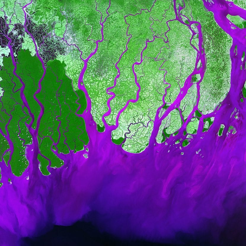
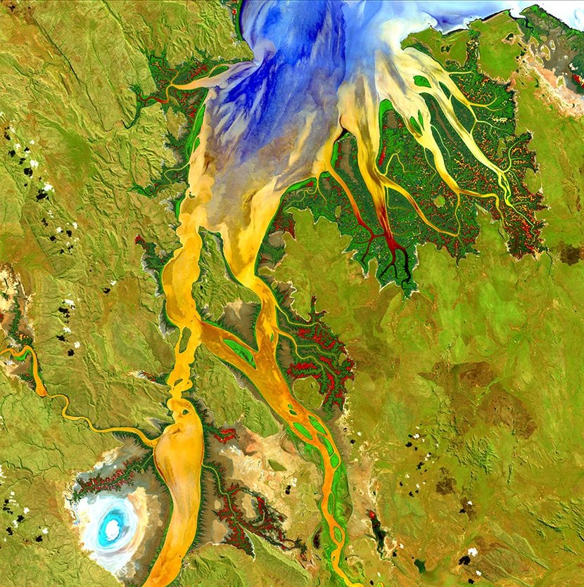
Ganges River Delta
The Ganges River forms a very extensive delta that reaches the Bay of Bengal.
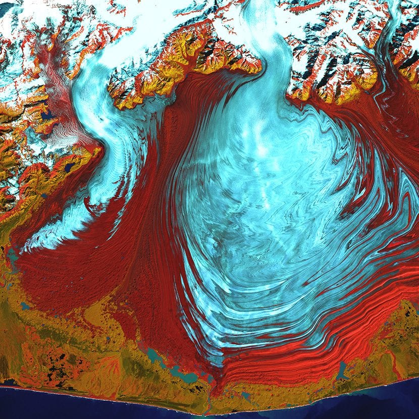
Malaspina Glacier
The tongue of the largest glacier in Alaska which covers 3880 square km. In the image we see well defined the flow that the water followed when it froze.
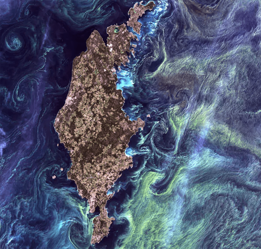
Phytoplankton in Gotland
This image shows "Van Gogh Starry Night" style large congregations of green phytoplankton off the shores of Gotland, a Swedish island on the shores of the Baltic Sea.
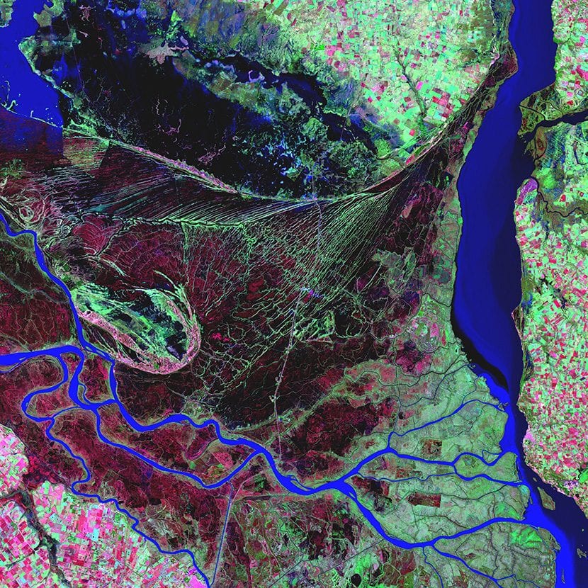
Paraná River Delta
The land surface represented with a bright green color that mutates between magenta that respond to the most populated areas, contrasting with the watery mass of the Paraná River
Land of terror
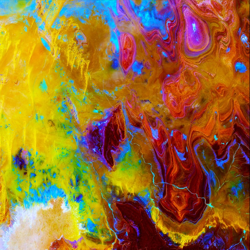
The patterns of nature
Without water, without vegetation, without oases, the Tanezrouft basin in Algeria is one of the most desolate regions of the Sahara.
The complex conditions of the mangroves are shown in a dark green color on the sides of the Ord River in Australia.
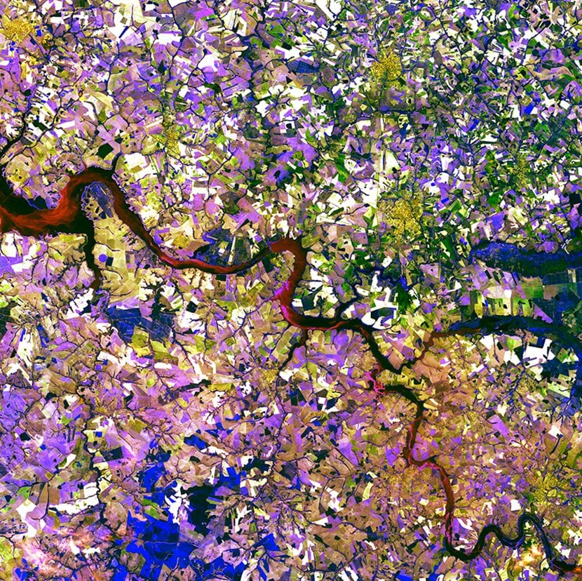
Tessera mosaic
The Tietê River meanders this tessera mosaic made of multicolored shapes in Ibitinga, Brazil.
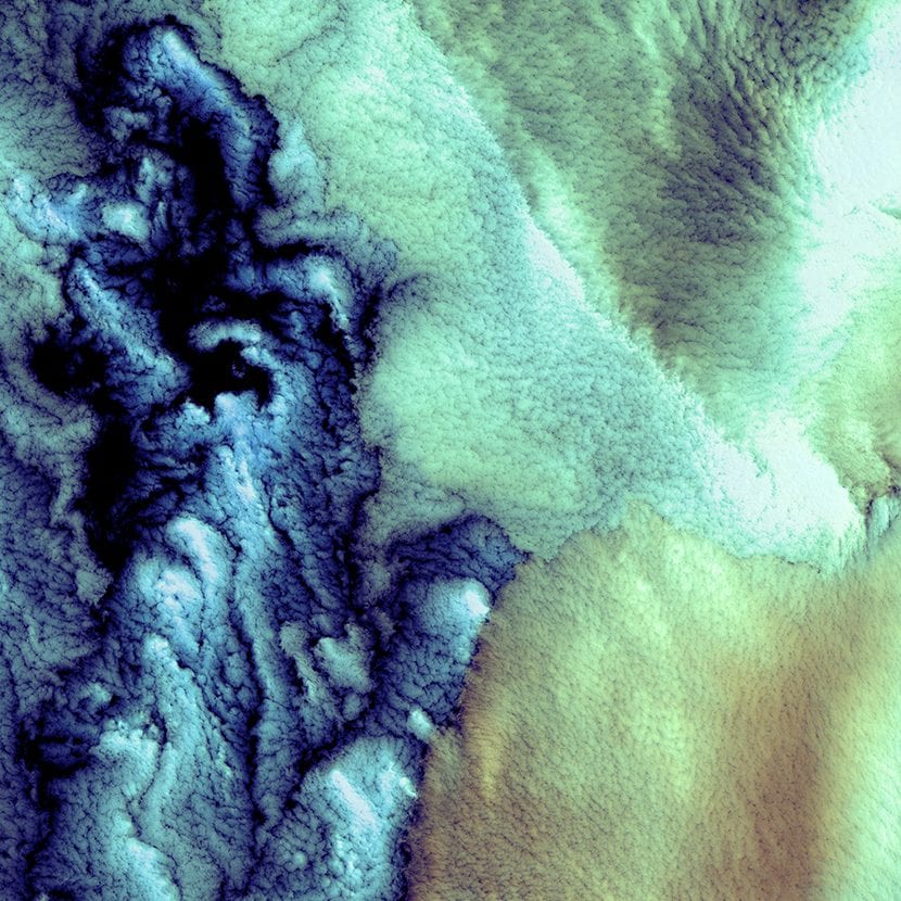
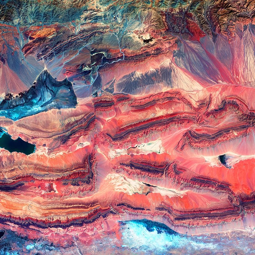
Fallas
When tectonic plates collide, layers of rock can break apart. Geologists call this phenomenon "faults." In this image you can see the different depth levels of the masses.
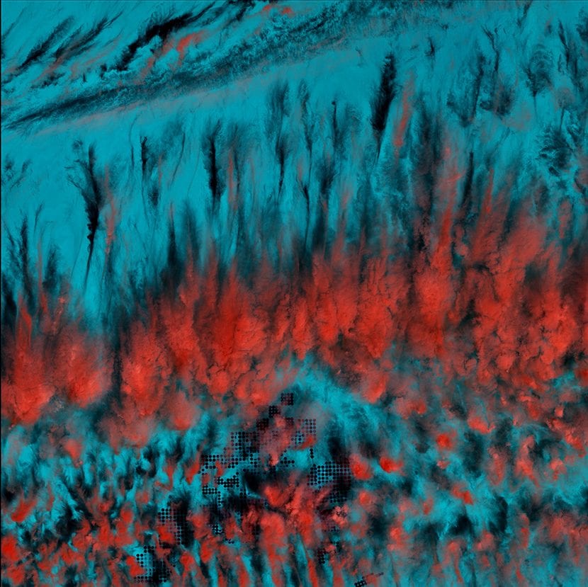
Mysterious cloud shadows
This image is composed of patterns generated by clouds mysteriously shaped in Egypt. The clouds appear red and the earth blue under the infrared effect.
To see the entire gallery of images collected by all Landsat missions click here You can download the images in JPG or TIF.
You can also buy the printed versions here